Henry Dove entered the quarter
section on which the village is located, in
about 1802 or 1803; prior to his death he
divided it and gave his son Reuben
the east half and his son Jacob the
west half, the center of High street being
the dividing line. Jacob afterward
sold his land to John Colman.
The first tree cut on the site of Winchester was a
walnut directly in front of the residence of
M. C. Whitehurst - now owned by
Wm. H. Lane, Esq. - where the Reuben
Dove homestead was located (Mrs. M.
C. Whitehurst was a daughter of
Reuben Dove). The first log
cabin was built of poles, on the same site,
in primitive fashion, without the use of
nails, iron, or glass. Some years
later a two-story hewed log house was
erected which stood until the present brick
house was built in 1865.
When the canal was begun in 1827 Mr. Dove
had the field, through which the canal was
to be dug, in wheat, and objected to having
it destroyed, but to no avail. Finally
he threatened to bring suit against the
state for damages to his crop. Some of the
workmen suggested to him that here would be
a good site for a town; being about half way
between Lancaster and Columbus, and said:
“We believe there will be more money in
laying out a town than in trying to collect
damages from the state.” Acting on
this suggestion, in company with John
Colman, they employed James
Pg. 162 -
O'Kane to survey and plat a town,
which was named Winchester, from the
fact that Mr. Dove's father formerly
lived at Winchester, Va., and accordingly on
Nov. 5, 1828, the following description,
accompanied by a plat, was recorded at
Lancaster, in Fairfield county: "The
within is a plan or plat of the town of
Winchester, laid off in the southeast
quarter of Section 30, Township 15, Range
20, of the land directed to be sold, by an
'Act’ of Congress, at Chillicothe; the lots
are four (4) perches in front and ten (10)
perches deep, and contain one-fourth acre
each, except the lots Nos. 9, 10, 17 and 18,
they being of a triangular form, as marked
on the within plat. The streets are
four (4) perches in width; High street runs
north and south; Columbus street runs with
the bearings of the canal, which is west, 25º
north; both are given for public use.
The lots are numbered, beginning at the
northeast corner, then west and east until
the same are numbered to twenty-five (25).
Given under my hand and seal, this 4th day
of November, 1828.
| |
(Signed) |
"JAMES
O'KANE, Surveyor
REUBEN DOVE.
(Seal.)
JOHN COLMAN." (Seal.) |
On Mar. 30, 1829, Mr. Dove
recorded an addition to the original
plot, being the lots on both sides of
Columbus street, to the east section
line and on both sides of Waterloo
street, beginning at High street and
continuing to the east section line;
they each contain one-fourth (¼)
acre, and are numbered from one to
fifty. Lot No. 17 (Arendt’s
shoe shop) is given for a basin, lot No.
44 (Vought’s) for school purposes
and lot No. 2 (Binkley’s) for
public use. May 3, 1836, David
Dixon laid out an addition, being
the lots between the canal and West
street, and between Wash-
ALSO
PICTURE OF WINCHESTER PLAT MAP
Pg.
163 -
ington street, and the alley just
west of High street, and the lots on the
south side of West street and east of
Liberty street. On Apr. 25, 1839
John Colman laid out an addition of
22 lots lying west of Liberty street,
and between West street and Franklin
alley. On Nov. 9, 1839, David
Dixon laid out his second addition,
consisting of 53 lots west of Washington
street, and between West street and the
canal. Clinton street then
extended to the canal. On Nov. 10,
1869, Wm. P. Miller laid out his
first addition, containing nine lots,
bounded by High, Friend and Mound
streets and Cherry alley. July 19,
1870, Wm. P. Miller's second
addition was laid out. It consists
of 22 lots on the east side of High
street, between Railroad street and the
alley just north of Waterloo street on
the south, reserving a two-acre lot
between Cherry, Town and ____ alleys.
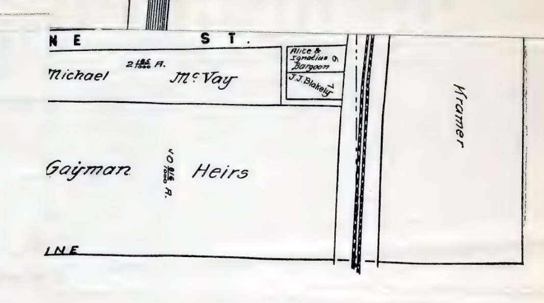
Dec. 16, 1870, John Kramer laid
out an addition consisting of 10 lots,
and bounded by Mound, Oak and Elm
streets and Mill alley, and on Feb. 2,
1874, he filed an amended plat, bounded
as following: High, Elm, Mound and
Oak streets. May 27, 1871,
Henry Will laid out an addition
consisting of 5 lots, bounded by Friend
(now Elm) streets on the east, Union
alley on the north, and the Columbus and
Winchester pike on the south and west.
Aug. 31, 1871, Reuben Trine laid
out an addition consisting of 27 lots on
the west side of Trine street, and
between Waterloo street and Railroad
street. Mar. 8, 1876, John
Kramer laid out his second
addition consisting of 8 lots, bounded
by High,
Pg.
164 -
Oak and Mound streets and Mill alley.
On Nov.
Pg.
165 -
Pg.
166 -
Pg.
167 -
Pg.
168 -
Pg.
169 -
Pg.
170 -
Pg.
171 -
Pg.
172 -
Pg.
173 -
Pg.
174 -
Pg.
175 -
Pg.
176 -
Pg.
177 -
Pg.
178 -
Pg.
179 -
Pg.
180 -
Pg.
181 -
Pg.
182 -
Pg.
183 -
Pg.
184 -
Pg.
185 -
Pg.
186 -
Pg.
187 -
Pg.
188 -
Pg.
189 -
Pg.
190 -
Pg.
191 -
Pg.
192 -
Pg.
193 -
Pg.
194 -
Pg.
195 -
Pg.
196 -
Pg.
197 -
Pg.
198 -
Pg.
199 -
Pg.
200 -
Pg.
201 -
Pg.
202 -
Pg.
203 -
Pg.
204 -
Pg.
205 -
Yost and Ethel Seymour
operators; E. L. Carlton,
physician.
1890 - 1898.
Clerks: W. D. Beeks, G. M. Herbst,
E. C. Chaney, John Bartlit, Geo. E. Fry,
Frank Hische, John Sponsler, Chas.
Sponsler, Henry Lechliter, Herb Cannon,
Wm. Bolenbaugh, Eliza Gayman, Alice
Snyder, Ona Kramer, Lou Shaffer, John
Gayman, Harry Beery, Herb Tobas, Milt
Armpreister, Harry Caslow, Henry W.
Lehman, Bert Miller, Geo. W. Hinrod,
Frank Dildine, Chas. Miller, Hugh Caslow,
Zack England, Harry Miller, Frank
Miller, Geo. W. Miller, Jacob Lehman,
Jesta Hancock, Noah Beery, A. D.
Bolenbaugh.
<
BACK to TABLE
of CONTENTS >
|
